A detailed map of Slough Cemetery and Crematorium is available to view or download. We recommend printing a copy and bringing it with you to help find your way around the grounds.
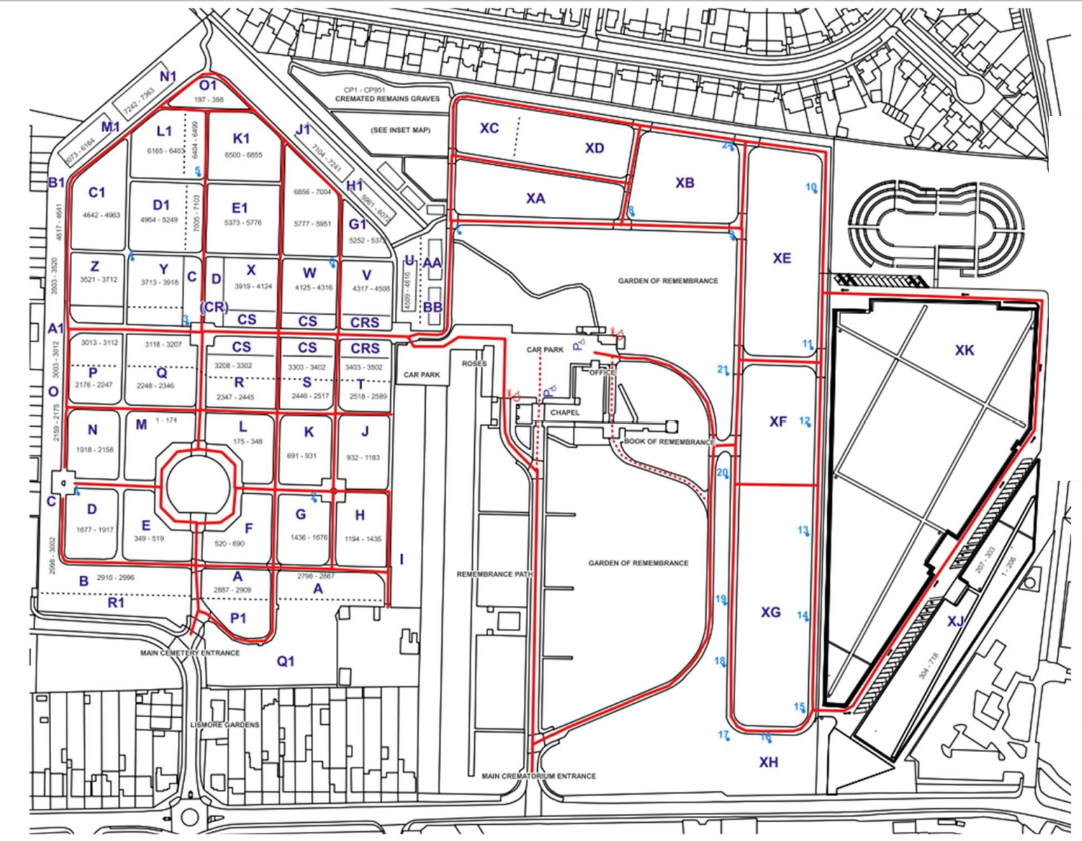
A detailed sectioned burial map of Slough Cemetery and Crematorium is available to view or download.
Entrances
- Cemetery entrance: via Lismore Park
- Crematorium entrance: directly off Stoke Road
Parking
Near the Crematorium Chapel:
- 35 standard parking spaces
- 6 disabled bays.
At Section XJ:
- Additional 6 disabled parking bays.
Around older sections (A–Z) and lawn graves (XA–XG):
- Visitors may park considerately on the main roadways
- Please do not park on grassed areas and always leave room for other vehicles to pass.
3 disabled bays are also located near Section V, just before the Cremated Remains area
Cemetery layout
- Grave sections are labelled A-Z, followed by A1, B1, up to O1
- Grave numbers range from 1 to 7,363 (numbers restart in new areas)
- Layout follows a grid system around the roundabout.
Oldest graves (from the 1930s) are closest to the main entrance.
Designated areas
- Muslim burial area (up to 2022): Sections R1, P1, and Q1 (near Lismore Park entrance)
- Children’s graves: Sections labelled CS – located straight ahead from the entrance, turn right after Section R
- Lawn grave sections: XA to XJ
- Section XH and XJ: Muslim burials
- Section XG: Current multi-faith burials
- Memorial shrubs: Left of the main crematorium drive
- Gardens of Remembrance:
- Right of the crematorium drive
- Beyond the crematorium car park
- New cemetery extension: Located in the raised area beyond Section XG